Hwy 20 & Lone Star Rd. Cropland
Description
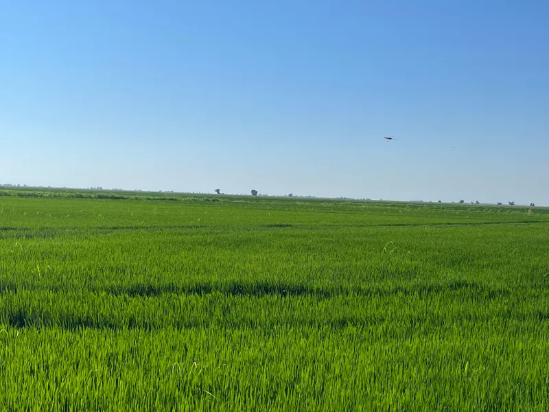
433.67 Acres located at the southwest corner of Highway 20 and Lone Star Road, between Williams and Colusa in Colusa County. One recently drilled well in addition to surface water from Zumwalt Mutual Water Company. Property is enrolled in the Williamson Act, so taxes will remain low at the close of escrow. The cropland consist of 415 net farmable acres in three fields that are generally leveled into straight checks for flood irrigation and has historically been farmed to rice. Water is gravity fed from adjacent delivery ditches to each of the fields.
Colusa County Parcels include:
015-010-027 (138.99 ac.)
015-110-028 (147.37 ac.)
017-010-026 (147.31 ac.)
Soils Include:
Willows Silty Clay (Class 3)
Water:
One New Well & Zumwalt Mutual Water Company
From elevation to risk assessment
Search for detailed parcel information including; Elevation & Vegetation Maps, Ownership Information, Detailed Parcel Information, Crop History Map, Soil Survey Productivity Data, and more.
Research Parcel InformationDirections
Three miles west of Colusa and three and one-half miles east of Williams at the Southwest corner of Lone Star Road and Highway 20.
Environmental Factors
Resources
Colusa County Properties By Type
- Farms for Sale in Colusa County, California
- Ranches for Sale in Colusa County, California
- Undeveloped Land for Sale in Colusa County, California
- Residential Property for Sale in Colusa County, California
- Hunting Land for Sale in Colusa County, California
- Commercial Property for Sale in Colusa County, California
- Horse Property for Sale in Colusa County, California
- Riverfront Property for Sale in Colusa County, California
- Recreational Property for Sale in Colusa County, California
- Lakefront Property for Sale in Colusa County, California
- Beachfront Property for Sale in Colusa County, California
- Timberland for Sale in Colusa County, California
Properties for Sale Nearby Counties
Colusa County Properties By City
- Arbuckle, California Land for Sale
- Colusa, California Land for Sale
- Grimes, California Land for Sale
- Maxwell, California Land for Sale
- Princeton, California Land for Sale
- Stonyford, California Land for Sale
- Williams, California Land for Sale
- Codora, California Land for Sale
- College City, California Land for Sale
- Fouts Springs, California Land for Sale
- Grand Island, California Land for Sale
- Leesville, California Land for Sale
- More
- Lodoga, California Land for Sale
- Sites, California Land for Sale
- Sycamore, California Land for Sale
- Wilbur Springs, California Land for Sale
- Arbee, California Land for Sale
- Bonnie View, California Land for Sale
- Boyers Landing, California Land for Sale
- Colusa Rancheria, California Land for Sale
- Cortena, California Land for Sale
- Cranmore, California Land for Sale
- Delevan, California Land for Sale
- Delphos, California Land for Sale
- Devils Elbow, California Land for Sale
- Fraziers Landing, California Land for Sale
- Genevra, California Land for Sale
- Graino, California Land for Sale
- Harrington, California Land for Sale
- Millers Landing, California Land for Sale
- Mills Orchards, California Land for Sale
- Stegeman, California Land for Sale