866.89 acres in Bosque County, Texas
Executive Summary
Location East side of CR 3310, a caliche/gravel road maintained by Bosque County. The property is approximately 28 miles northwest of the intersection of Interstate 35 and State Highway 6 in Waco, Texas. By road, it is about 5 miles northwest of Valley Mills and 8 miles southeast of Clifton, Texas. Lake Whitney is approximately 15 miles northeast.
Directions From Valley Mills, go north on SH 6 approximately 2.2 miles and turn right onto River road/CR 3310. From the bridge over the Bosque River, continue approximately 2.3 miles to the ranch entrance, on the right.
Size 866.886 Acres per Bosque County Tax Records
Dimensions 4,213 feet of frontage along CR 3110 (West Boundary)
(Per 1993 survey) 4,707 feet at East Boundary
8,044 feet at South Boundary
7,727 feet at North Boundary
Utilities Childress Creek Water Supply Corporation in Clifton
(254-675-2603m Attn: Darren Hanson)
Heart of Texas Electric Coop, formerly McLennan County Electric Coop
(254-840-2871)
Elevations Approximately 685 feet to 800 feet above sea level, with the higher elevations in the central and eastern portions of the property.
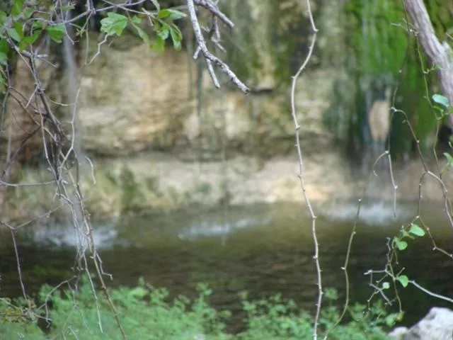
Water Seasonal creeks traverse the property from the east and northeast to the west and southwest. Several small springs exist on the property, which keep small pools wet in several locations along creek beds year round. There are two earthen stock ponds along these drainages in the central and eastern portion of the property. During seasonally wet time, waterfalls of 5 to 10 feet are prominent in at least 3 locations as water flows over limestone outcroppings along the creeks.
Soils Primarily Brackett-Eckrant; Eckrant; and Purves-Maloterre associations. These are generally well drained soils types and are underlain by limestone.
Trees Oaks (Live Oak, Spanish Red Oak, Post Oak and others) are dominant. However, heavy cedar cover inhibits hardwood growth on several hillsides. Mature cedars may exist in marketable quantity. Tree canopy and brush covers more than 70% of the property.
Minerals There are no current oil and gas leases on the property and there is no evidence of production on surrounding properties. The seller will convey 50% of owned minerals. Deed records do not indicate any mineral reservations since 1917 and the sellers ownership may be 100%.
Wildlife Native wildlife game species include whitetail deer, wild turkeys and doves. In addition, wild pigs have been frequenting the northern and eastern portions of the ranch recently. There is no cross-fencing to hinder game movement. There is an ample supply of available forage, brush cover and water which supports a sizable wildlife population.
Fencing The northern property line borders a high-fence in excellent condition. Portions of the southern fence line are cable and net wire. However, the eastern and western fences are in poor to fair condition and consist primarily of 2 or 3 strands of barbed-wire over net wire between cedar posts and fence stays. There is no cross-fencing.
Cemetery The Centerpoint Cemetery, comprising less than an acre, is located near the northwest corner of the property It is about 200 yards from CR 3310, southeast of an old church site located on the adjoining fame-fenced ranch. A few legible headstones mark graves from the 1880s to 1910.
Leases None. Grazing and hunting leases were terminated early in 2011.
Price $2,297,250.00 or $2650 per acre
DISCLAIMER
The enclosed information if from sources believed to be reliable, but Ranch Connection, LLC has not verified the accuracy of the information. Ranch Connection LLC makes no guarantee, warranty or representation as to the information, and assumes no responsibility for any error, omission or inaccuracy. The information is subject to the possibility of errors, omissions, changes in condition, including price or rental, or withdrawal without notice. Any projections, assumptions or estimates are for illustrative purposes only. Recipients should conduct their own investigation.
From elevation to risk assessment
Search for detailed parcel information including; Elevation & Vegetation Maps, Ownership Information, Detailed Parcel Information, Crop History Map, Soil Survey Productivity Data, and more.
Research Parcel InformationDirections
From Valley Mills, go north on SH 6 approximately 2.2 miles and turn right onto River road/CR 3310. From the bridge over the Bosque River, continue approximately 2.3 miles to the ranch entrance, on the right.
Land for Sale by Cynthia Inman
Bosque County Properties By Type
- Ranches for Sale in Bosque County, Texas
- Hunting Land for Sale in Bosque County, Texas
- Residential Property for Sale in Bosque County, Texas
- Farms for Sale in Bosque County, Texas
- Undeveloped Land for Sale in Bosque County, Texas
- Riverfront Property for Sale in Bosque County, Texas
- Lakefront Property for Sale in Bosque County, Texas
- Recreational Property for Sale in Bosque County, Texas
- Commercial Property for Sale in Bosque County, Texas
- Horse Property for Sale in Bosque County, Texas
- Timberland for Sale in Bosque County, Texas
- Beachfront Property for Sale in Bosque County, Texas
Properties for Sale Nearby Counties
Bosque County Properties By City
- Clifton, Texas Land for Sale
- Cranfills Gap, Texas Land for Sale
- Iredell, Texas Land for Sale
- Kopperl, Texas Land for Sale
- Laguna Park, Texas Land for Sale
- Meridian, Texas Land for Sale
- Morgan, Texas Land for Sale
- Valley Mills, Texas Land for Sale
- Walnut Springs, Texas Land for Sale
- Brazos Point, Texas Land for Sale
- Eulogy, Texas Land for Sale
- Lakeside Village, Texas Land for Sale
- More
- Lakewood Harbor, Texas Land for Sale
- Mosheim, Texas Land for Sale
- Norse, Texas Land for Sale
- Smiths Bend, Texas Land for Sale
- Womack, Texas Land for Sale
- Bosque, Texas Land for Sale
- Cayote, Texas Land for Sale
- Cedar Shores, Texas Land for Sale
- Crossroad Store, Texas Land for Sale
- Glass, Texas Land for Sale
- Greenock, Texas Land for Sale
- Pendell, Texas Land for Sale
- Rock Springs, Texas Land for Sale
- Spivey Crossing, Texas Land for Sale